









PROPERTY SEARCH

Spain weekend weather forecast October 15-18: Warm Thursday gives way to storms and a proper autumn cooldown
High pressure holds on Thursday and Friday before an Atlantic front sweeps in at the weekend, bringing widespread rain, thunderstorms and a sharp drop in temperatures
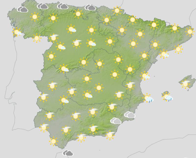
After a largely settled and unseasonably warm week, with Seville nudging 30°C and much of the mainland enjoying sunshine, the change this weekend is marked. The high pressure that gave Spain a brief late-summer reprieve moves away, and from Saturday the country gets a reminder that October is well under way.
Thursday October 15
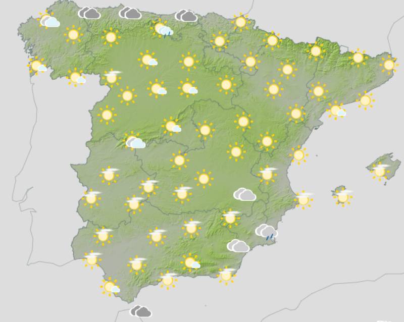
High pressure still holds its grip for now, with mostly clear or partly cloudy skies across the mainland. The southeast sees some coastal showers that could be locally heavy, and morning mist and fog patches are possible in Mediterranean areas and the eastern interior. Very strong easterly gusts are expected in the Strait of Gibraltar, so conditions around the Alboran Sea will be lively. The Cantabrian coast and Galicia see more cloud, with some afternoon shower risk in the mountain ranges inland. Temperatures broadly unchanged across most of the country, with the south staying warm.
Friday October 16
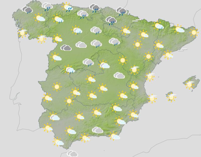
Another largely stable day, though the first signs of change begin to appear. Morning fog and mist linger in the north and east, clearing through the day. Cloud builds over the southern and central mountains in the afternoon, with showers and thunderstorms possible, most likely in the southeastern mountain ranges. The north sees rain arriving with a front pushing in from the Atlantic, and the Cantabrian coast turns noticeably wetter and windier by the end of the day. Maximum temperatures dip in the north-central and northwest, while rising in the eastern third. The south holds on to its warmth a little longer.
Saturday October 17
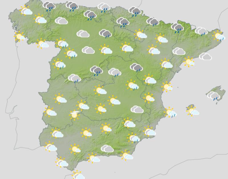
The front arrives in earnest. An upper-level trough and a cold air influx bring very cloudy skies and rain across almost the entire peninsula, with heavy showers and thunderstorms in the eastern third and the Balearic Islands. The Cantabrian coast is wet and blustery in the morning, the southeast and Balearics bearing the brunt in the afternoon. Temperatures fall across the country, significantly in the north, reaching what really are normal autumn levels for the first time in weeks. Strong Tramontana winds in the northeast, a vigorous Cierzo in the Ebro Valley and moderate northerly winds across much of the interior complete a properly autumnal picture.
Sunday October 18
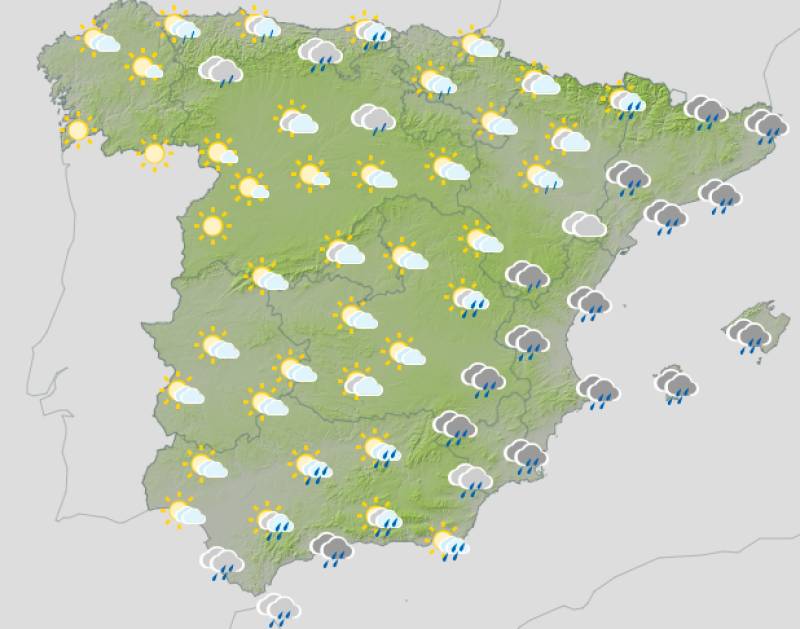
Unsettled conditions continue, particularly in the Mediterranean region. The most significant weather is expected in Catalonia, the Balearic Islands, and the eastern Valencia and Murcia coast, where very heavy thunderstorms and significant rainfall totals are possible. Snow is expected on the highest Pyrenean peaks. The south and far west are calmer, with Galicia and the northern plateau actually seeing clearer skies by this point. Temperatures keep falling, particularly in central and eastern areas. Strong and very strong winds along the northwest and Cantabrian coast, with the Tramontana extending down the eastern seaboard.
Thursday and Friday feel like a last hurrah for the warmth, but from the weekend onwards Spain is firmly in autumn mode, Saturday brings the real turning point, and by Sunday the focus shifts to the eastern Mediterranean coast where the storm risk is most significant.
For more weather news go to our Weather & Climate page or follow the Spain Weather Watch Facebook group for regular updates
Images: Aemet