









PROPERTY SEARCH

Spain weather forecast October 22 to 25: Storm Austen brings orange alerts and 7m waves
Atlantic fronts will drench the north of Spain while the rest of the country stays mostly dry and cooler
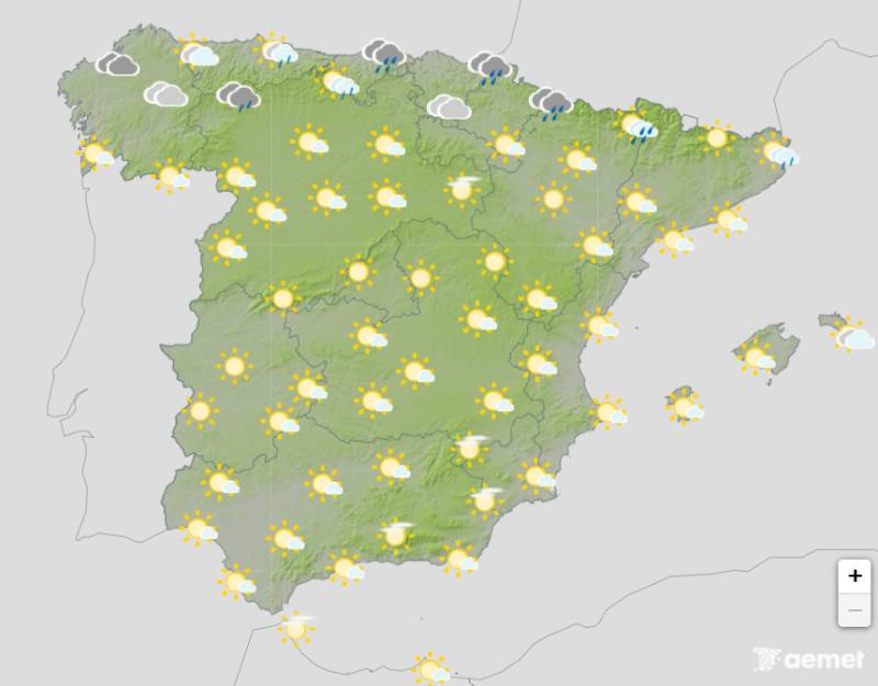
Weather outlook on Friday
Spain is leaving DANA Adam behind and heading into a spell of Atlantic weather, with up to three fronts bringing rain to the north of the country between Thursday October 22 and the weekend.
The Mediterranean storm that caused so much disruption earlier in the week is over, as its last rain and thunderstorms came on Tuesday before it was absorbed by a trough in the Atlantic. Most of the country will now see stable weather, although the Canary Islands will keep showers and intense storms from their own DANA until Friday.
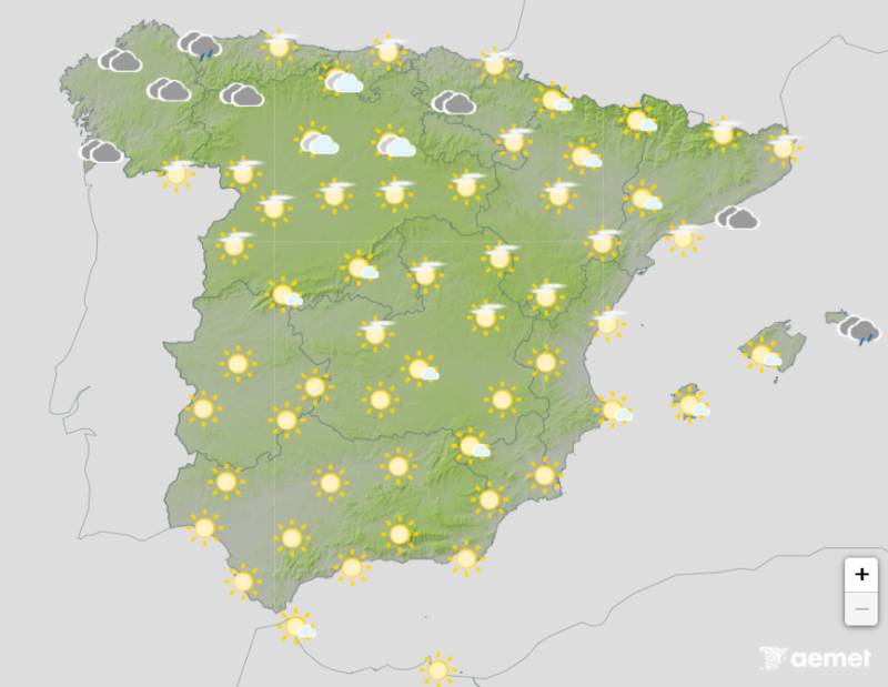
Weather outlook on Thursday
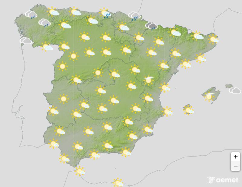
Thursday October 22 is a transition day between fronts, with settled conditions across most areas, but a second front linked to Storm Austen will enter Galicia late in the afternoon. Southerly winds will strengthen there and waves of 4 to 5 metres are expected, with yellow warnings already issued for the coasts of A Coruña and Lugo. Rain could be heavy in Galicia overnight before it moves across Asturias, Cantabria, the Basque Country and the northwest of Castilla y León.
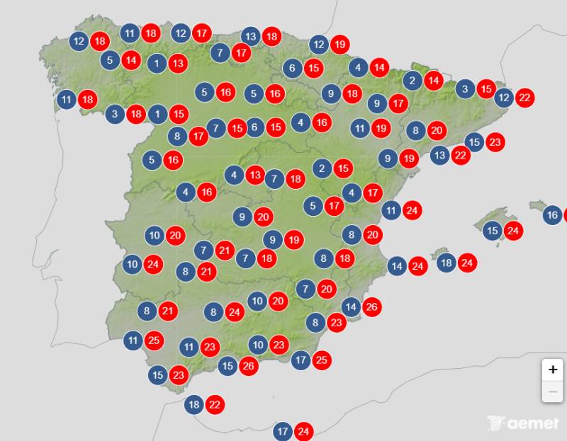
Average temperatures expected on Friday
On Friday October 23 the rain will continue along the Cantabrian coast and reach the Pyrenees, intensifying in the afternoon as northerly winds set in behind the front. The heaviest falls are expected in eastern Cantabria and the western Pyrenees, with showers in the northeast of Cataluña until early Saturday and a chance of rain in the Balearic Islands during the early hours.
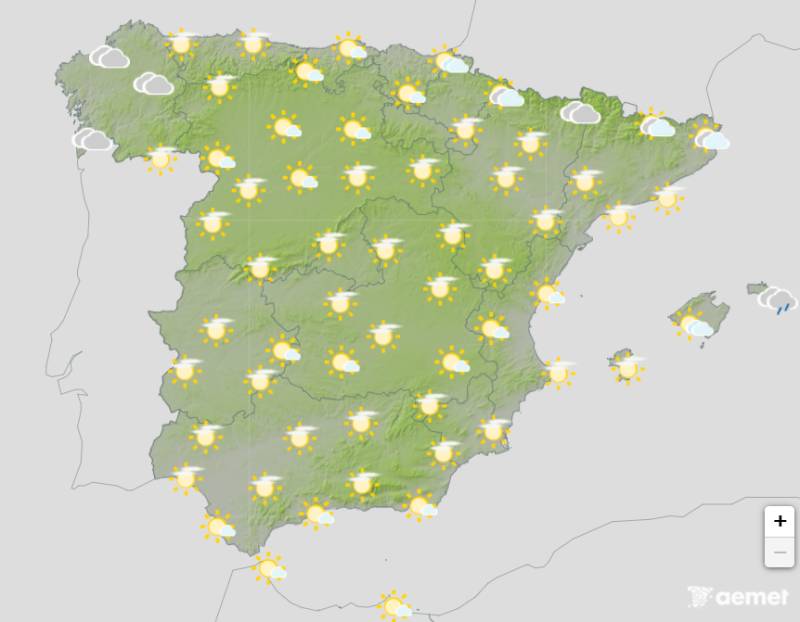
Weather outlook on Saturday
Wind will be the main concern. Gusts of 60 to 80 km/h are possible in northern Galicia and along the Cantabrian coast in the early hours, followed by gusts of 60 to 70 km/h on the Cantabrian coast, in the Pyrenees and especially in the Ebro Valley during the afternoon. Waves could pass 7 metres on Friday, and the entire coast of Galicia and the Cantabrian Sea has an orange alert.
Weather outlook on Sunday
More of the same is on the way over the weekend, as another front could reach the north between Saturday October 24 and Sunday October 25, bringing rain that could be heavy in the Pyrenees and again affecting Galicia and the Cantabrian coast.
By the end of the week, the eastern Cantabrian region and the northern slopes of the western Pyrenees could see almost 50mm in total. Elsewhere it will stay dry with spells of cloud and more sunshine the further south you go, although it will stay cold and autumnal, especially at night, with the chill increasing over the weekend.
For more weather news go to our Weather & Climate page or follow the Spain Weather Watch Facebook group for regular updates
Images: Aemet