


PROPERTY SEARCH


Mar Menor experts partly blame farmers for contaminating water supply
The Taibilla Canal Association believes that land "modification" caused a "mud tsunami" in San Javier
A question has been circulating among residents in several municipalities of the Mar Menor ever since Dana Alice forced the authorities to shut off their water: why did this flood result in drinking water being contaminated with mud, when it’s never happened before?
Almost a week after torrential rain battered parts of Murcia and Alicante, more than 100,000 people in the likes of San Javier, Los Alcázares and San Pedro are still without this vital resource as technicians work flat out to clean and sanitise the water tanks.
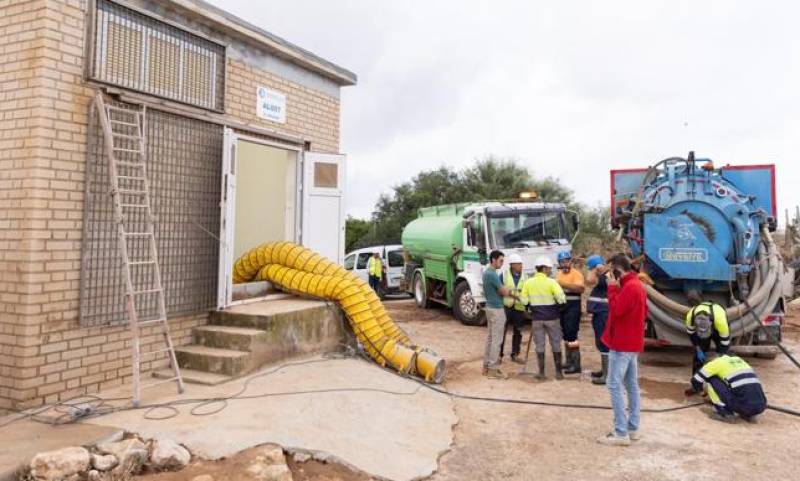
The Taibilla Canal Association (MCT), chaired by Juan Cascales, has blamed this very serious problem primarily on changes made to the land in Campo de Cartagena near El Mirador in San Javier. He explained this week that muddy rainwater had been carried into the area where Tabilla’s main canal and distribution centre are located, resulting in the contamination.
"The modification, in recent years, of the existing plots above the affected canal has caused rainwater to concentrate in a mud-filled stream that has flooded one of our facilities and contaminated a 20-kilometre stretch of canal," he said.
Of course, the Tabilla boss stressed that, even with these land modifications, the water crisis wouldn’t have occurred if not for an almost unprecedented amount of rainfall.
"What happened in this episode must be understood as an absolutely exceptional event, the result of a climatic catastrophe. The flood that devastated the area where the beacon is located, through which mud entered and contaminated a section of the canal, produced rainfall records exceeding 180 litres per square meter."
And he added that "this fact, combined with the modifications to the terrain surrounding the beacon, both upstream and downstream, caused the infrastructure to be flooded by a veritable tsunami of mud."
Taibilla explained that the heavy rainfall collected in the upper areas and, as a result of the modifications made to the terrain in recent years, was channelled into a flow, a “river of mud”, which created a dirty pool around the facility.
According to the experts, it’s difficult to estimate the exact number of tonnes of mud that may have entered the so-called New Cartagena Canal.
Meanwhile, Ecologistas en Acción have turned their attention to land upstream from El Mirador, to the north of this area in the Mar Menor basin. Here, the number of greenhouses has drastically increased, they claim, and farms have been cleared and converted to build solar plants.
"Hundreds of hectares are occupied by intensive irrigation, greenhouse crops and solar farms without any land-use planning criteria,” a spokesperson pointed out, adding that the clearing and flattening of land for these economic activities and for citrus production is the cause of the flooding and destruction in El Mirador and other rural and urban areas.
So far, the four kilometres closest to 'ground zero' have been cleared. The canal is about two metres wide and in some areas the mud reached 50 centimetres.
What most can agree on is that the water distribution system needs to be moved to prevent this happening again in the future. This process will begin once the drinking water supply has been restored.
Image: MCT